Byurakan & Around

|
1. Byurakan Churches 2. Catholicos Summer Residence 3. Amberd Fortress 4. Tegher Monastery 5. 54m Radio-Optical Telescope 6. Arshakuni Kings Cemetery 7. Mount Aragatz 8. Aragatz Cosmic Ray Station 9. Mashtots Grave in Oshakan 10. Armenian Alphabet Monument 11. Byurakan Music Academy 12. Saghmosavank 13. Ohanavank 14. Byurakan Astrophysical Observatory 15. Agarak Archaeological Site 16. Museum of Traditional Festivals |
Byurakan Churches
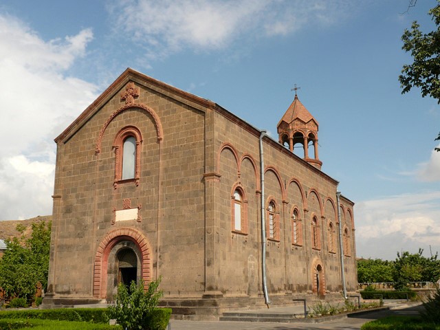
The St.Hovhannes church was built in the first quarter of 10c. At the late mid-century the vault and entries were re-constructed, then double walls from the north and the west were built. In 19 century the church still had the chapels from both sides, where religious ceremonies took place, but in 1841 after re-building the vault of the church, the ceremonies were held there. In 18 c. the Catholicos Hakob Djughaetsi made Byurakan the property of St. Echmiadzin. And in 1874 Catholicos Gevorg IV made it the patriarch’s residence.
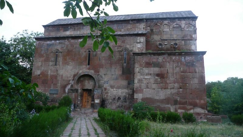
Catholicos Summer Residence
Amberd Fortress
Amberd is a 7th-century fortress located 2,300 meters (7,500 ft) above sea level, on the slopes of Mount Aragats at the confluence of the Arkashen and Amberd rivers in the province of Aragatsotn, Armenia. The name translates to "fortress in the clouds" in Armenian. It is also the name incorrectly attributed to Vahramashen Church, the 11th-century Armenian church near the castle. The village of Byurakan is located 6.4 kilometres (4.0 mi) from the site of Amberd.
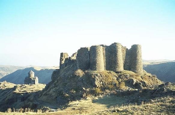
The site started as a Stone Age settlement. During the Bronze Age and Urartian periods, a fortress had been built that is now obsolete. Some sources say that Amberd used to be a summer residence for kings. The castle of Amberd and some sections of walls were constructed in the 7th century as a possession of the noble House of Kamsarakan.
Four centuries later the fortress and surrounding lands were purchased by the House of Pahlavuni and rebuilt by Prince Vahram Vachutian Pahlavuni, as is recorded in the manuscripts of Grigor Magistros Pahlavuni. Vahram built the Church of Surb Astvatsatsin in 1026, fortified the complex with thicker stone walls, and added three bastions along the ridge of the Arkhashen canyon. Despite being unusual for a military installation, a bath house was built in the same period and has remained moderately intact along with the water supply system.
Amberd was invaded in the 1070s by the Seljuq Turks who turned it into a military base. In 1197, a joint-army of Georgians and Armenians led by General Zakareh Zakarian liberated the fortress. Under Zakarian control during the 12th and 13th centuries, the walls were structurally reinforced and the castle and outer buildings were renovated.
The noble Vacheh Vachutian purchased Amberd in 1215, making it a key defensive site in the region. Within a short period of time, the Mongols captured and destroyed the fortress in the year 1236. The site remained abandoned and untouched until the 20th century, when reconstruction and archaeological excavations began.
Tegher Monastery
The Tegher monastery complex of the 13th century is located in the Tegher village of the Aragatzotn district. The vaulted church and the bell-tower are part of the monastery. According to the inscription the church was built by Mamakhatun (wife of King Vache Vachutyan), and by the architect Aghbayrik.
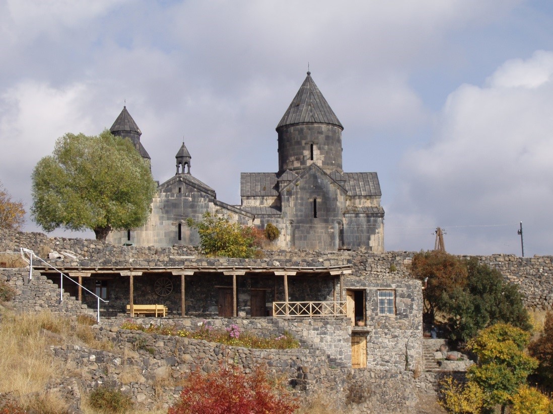
The monastery is located on top of a small hill and is made of dark grey bazalt. To the west of the monastery, attached is a bell-tower with a size larger than that of the church. Original and unique is the north-western and south-western corners of the bell-tower’s roof with its vaulted altars. Those altars are in memorial of those who passed away, and who were buried in the bell-tower.
The Tegher village was well-known because of its plentiful healing herbs, grown on its territory, and that’s the reason for its name Tegher (Arm. դեղեր - medicine).
54m Radio-Optical Telescope
Arshakuni Kings Cemetery
Mount Aragatz
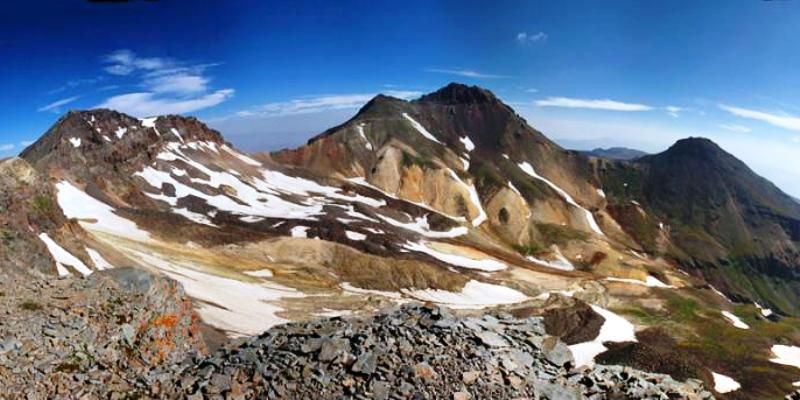
Aragatz is the highest mountain of Armenia and the forth of Armenian highland. The mountain has four summits. The highest of them is the Northern (4090m), in the second place is the North-Western (4080m), then the Eastern (3916m) comes and the last one is the Southern (3879m). The length of foot outline is 200km. There is a crater (length - 3 km, depth - 350m) between the summits which in the south-eastern part is connected with the surrounding by erosion cleft.
The origin of the name is connected with the name of Ara or Ara Geghetsik (Ara the Handsome, who is the same Argishti King) who was the ancient god of death and resurrection. Traces of ancient primitive man’ culture and irrigation networks, huge stony fishes (vishapakar) carved in water sources, as well as the remarkable monuments of medieval architecture (Amberd, Tegher) on the slopes of Aragatz were preserved.
The mountain is divided by radiated, large valleys such as Gegharot, Amberd, Mantash etc. A lot of scold springs flow out from Aragatz Mountain. Rainwater and springs form lot of rivers - Gegharot, Amberd, Narishd, Mantash, Geghadzor, Tzaghkahovit and so on. There are also many beautiful lakes (Kari, Amberd, Lesing etc). Here alternate to each other semi-desert, dry mountain prairie, alpine and snowy zones. The climate changes with altitude. The average annual temperature varies from -3°C to 10°C from the foot (1000m) to the top, precipitation - 300-900mm and more. On slopes, summer is moderately warm, winter - cold.
Near summits the weather in summer is cool, sometimes cold. Winter is long, harsh and snowy. The average numbers of days with temperature below 0°C are 220. There is permanent snow cover (average - 250 days in a year).
Mountain massif is rich in grasslands and lush alpine pastures. Meadows are full of sweet-smelling flowers - violet, wild lily, poppy, bell etc. Multi-colored “alpine carpets” and snowy vegetation are characterized to the high mountain zone. There is small oak forest in the southern slope. The representatives of wildlife are hare, fox, wolf, lizards, turtles, snakes and many birds.
Mountain massif is a shield-shaped elevation, covered with volcanic lava. Later, on the elevation was formed the volcanic cone. Volcanic crater transformed into the theater, surrounded by rocky peaks by the influence of ancient glaciations. Relict glaciers can be found at the bottom of it.
Byurakan Observatory located in the south-eastern slope of the mountain. Cosmic Rays Researches as well as Meteorological Stations are located in apical plateau. There is also a large reservoir in Mantash valley. Here are mined building materials of volcanic origin such as tuff, pumice, perlite etc.
Aragatz Mountain closely connected with Armenian tourism. This is one of the most popular mountains of Armenian people. A lot of songs and poems are devoted to Aragatz Mountain.
Aragatz Cosmic Ray Station
Mashtots Grave in Oshakan
Oshakan was being reminded, since the 5th century, where Vahan Amatouny the Keiser summed up the cinders of Mesrop Mashtots, the author of the Armenian Letters, and founded a Church on his grave which was replaced by a church named after St. Mesrop Mashtots. Every year, on September, many pupils of the first year study the first letters of the Armenian alphabet in this very church after giving a solemn oath to the grave of Mashtots.
Armenian Alphabet Monument
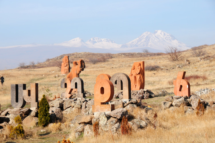
The Monument of Armenian Alphabet is situated in Artashavan village on the eastern slope of Aragatz. It was built in 2005 in the honour of the creation of Armenian letters in 1600 by the project of outstanding architect Jim Torosyan. The monument represents the 39 tracery letters of Armenian Alphabet.Armenian letters were created in 405-406 and are still used for introducing Armenian language in written form. It was raised by church leader Mesrop Mashtots for the Bible to become available for Armenians and to extend the Christianity. At first Mashtots Alphabet consisted of 36 letters, which were completed in the Middle Ages.
Byurakan Music Academy
Byurakan Academy It is the only in the region and is called for serving as an education center designed to train world class soloists where the most popular musicians of our time and influential cultural workers conduct master classes and organize concerts, thereby preparing grounds for talented and promising young musicians to make progress in the international arena.
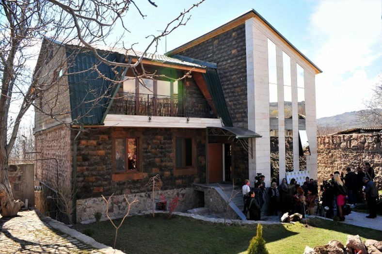
As a place for the academy construction, Byurakan was chosen for a few reasons: it is an academic settlement where the Byurakan Astrophysical Observatory has been operating since 1947. There are a number of valuable historical monuments there, such as the Basilica of Saint Hovhannes, Tegher Monastery, the Residence of Catholicos and Artavazik Church. Amberd, the physics institute and other places of scientific and educational importance are located not far from Byurakan.
Saghmosavank
Ohanavank
Byurakan Astrophysical Observatory
Agarak Archaeological Site
Museum of Traditional Festivals
Address: Str. 16, house N 12 Byurakan
Phone: + 374 94126501, +374 311301
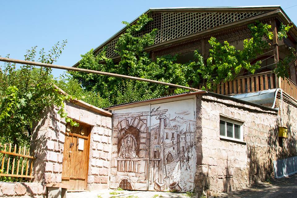
The museum was founded in February 2010 by "Tonatsuyts" Folk Theater. Here you can see and learn more about Armenian traditional festivals. Here you can find healthy food and traditional dishes. There is a B&N on the second floor. We are inviting you to be a member of our FOLK CLUB, so, last Sunday of every month we are celebrating together seasonal festivals. Every Sunday at 14.00 you can frequenting our heritage school, were you’ll learn ethnography, songs, dances, decorations connected with Armenian traditional folk festivals. The museum also organizes special event by orders for you and your group.